- Applications
- Maps & Navigation
GPS Fields Area Measure App
| Install | 71 K |
| From 20 Rates | 3.9 |
| Category | Maps & Navigation |
| Size | 8 MB |
| Last Update | 2026 February 20 |
| Install | 71 K |
| From 20 Rates | 3.9 |
| Category | Maps & Navigation |
| Size | 8 MB |
| Last Update | 2026 February 20 |
Images


Introduction
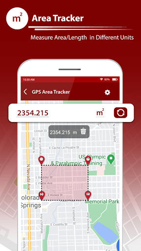
GPS Fields Area Measure App is a simple and reliable tool to measure land area, distance, and location directly on the map using GPS. It is useful for farmers, surveyors, engineers, travelers, and anyone who needs accurate measurements of fields, plots, routes, or locations.
With an easy-to-use map interface, you can mark points on the map to calculate area and distance instantly. The app also provides compass direction, current location details, coordinates, and a built-in unit converter for everyday measurement needs.
You can use this app to measure farms, gardens, land plots, roads, routes, and open areas without physically visiting the location. Results are displayed clearly and can be viewed in different measurement units.
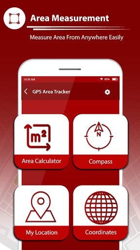
Key Features
• Measure land and field area on the map
• Calculate distance between multiple points
• View current location with latitude and longitude
• Find coordinates of any place on the map
• Built-in compass for direction
• Unit converter for length, area, mass, speed, time, and volume
• Simple map type selection (normal, satellite, terrain, hybrid)
• Share measured results easily
• Works smoothly with GPS and maps interface
This app is designed to be user-friendly and practical for real-world measurement tasks, whether for agriculture, construction planning, travel, or personal use.

